See It In Action
Available on iOS and Android
iPhone
Android
Available on iOS and Android
iPhone
Android
Professional GPS tracking, comprehensive land rights data, and wilderness safety resources
The ONLY app that shows metal detecting and treasure hunting permissions. Know before you search.
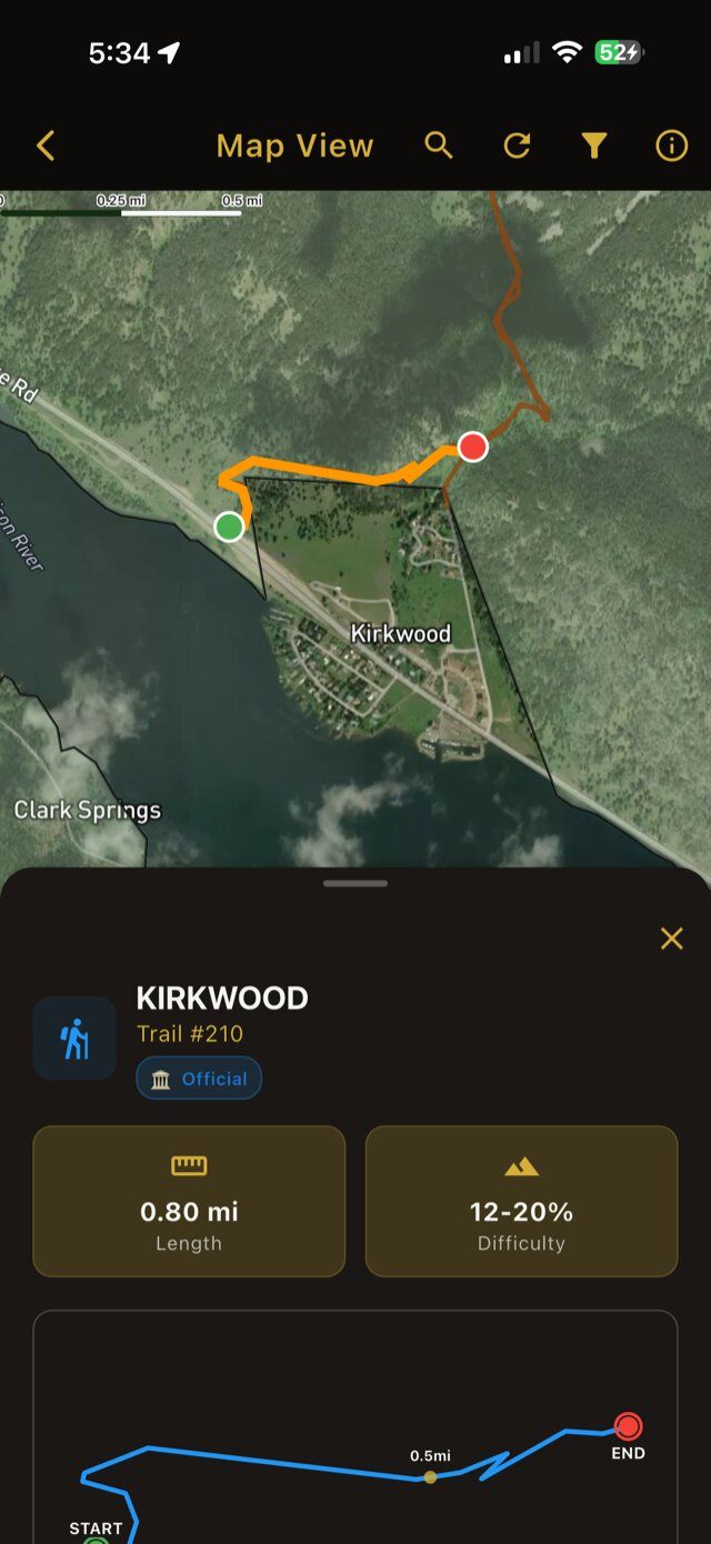
Survey-accurate GPS coordinates (8-decimal precision) show exact property lines. Know before you cross.
Track multiple armchair hunts, geocaches, or treasure quests. Keep all your research organized in one place.
Access 100K+ miles of USFS, BLM, NPS, and State trails. Find legal access points to public lands.
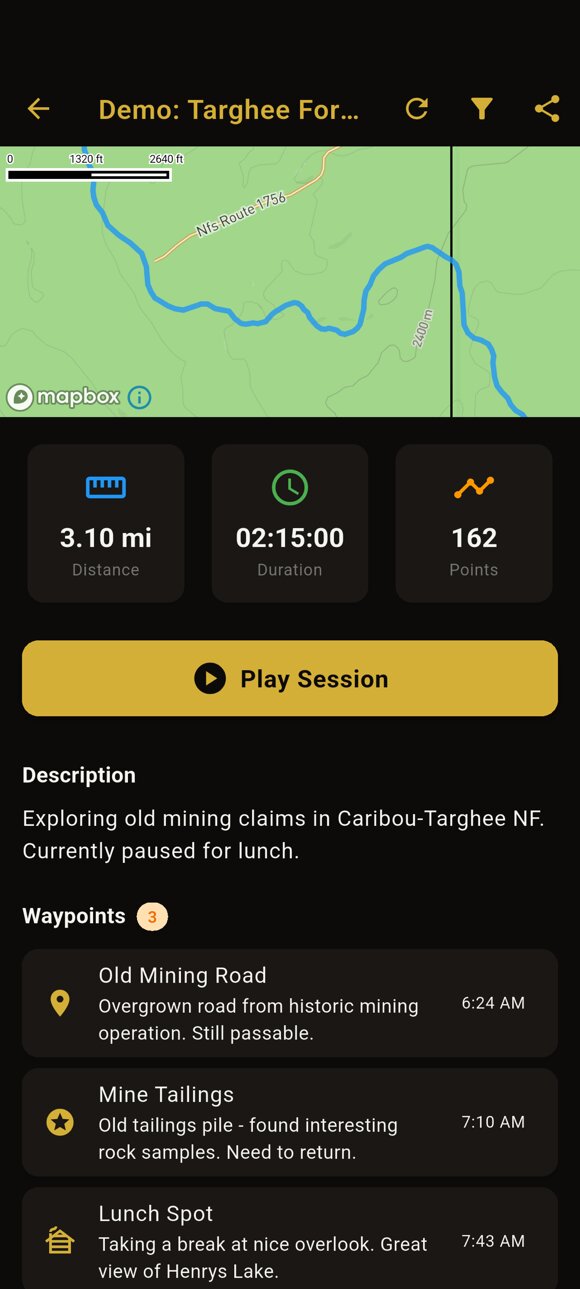
Track every hunt with precision waypoints, geotagged photos, and multi-day sessions. Export to GPX/KML.
Relive your entire adventure. Photos captured during tracking include location, direction facing, elevation, and timestamp.
We don't collect your data. Your locations, tracks, and finds are stored on your device—not uploaded to our servers. We don't have access to your hunting spots.
Half the price, more relevant features, better privacy
| Feature | Obsession GPS Tracker | Other Apps |
|---|---|---|
| Price | $49.99/year | $99.99/year |
| Property Boundaries | ✓ | ✓ |
| Metal Detecting Permissions | ✓ | ✕ |
| Treasure Hunting Permissions | ✓ | ✕ |
| ARPA Compliance Features | ✓ | ✕ |
| Your Data Stays on Your Device | ✓ | ✕ |
| Trail Data (USFS, BLM, NPS) | ✓ | ✓ |
| Offline Maps | ✓ | ✓ |
| Treasure Hunt Organizer | ✓ | ✕ |
| Journey Replay with Photo Metadata | ✓ | ✕ |
| Wilderness Safety Resources | ✓ | ✕ |
| Target Audience | Treasure Hunters | Hunters |
Save $50/year and get features other apps don't offer
Start free. Upgrade when you need land rights data.
Other apps are designed for hunters. We're designed for treasure hunters. We show activity-specific permissions for metal detecting and treasure hunting, ARPA compliance guidance, and all the land rights data you need - at half the price ($49.99 vs $99.99/year).
No account. No cloud. We don't collect your data. Your GPS tracks, waypoints, photos, and treasure hunt research are stored on your phone—not on our servers. We don't have access to your locations, tracks, or finds. Premium subscriptions are handled through the App Store / Google Play—we don't see your payment details either.
Yes! GPS tracking works completely offline. Premium users can also download land rights data for offline use. Perfect for remote locations without cell service.
We use survey-accurate data with 8-decimal precision (sub-centimeter). Our data comes from the same sources used by professional surveyors: county assessor records, federal land databases, and GIS systems.
For each land parcel, we show whether metal detecting, treasure hunting, and other collecting activities are allowed, prohibited, or require a permit. We also show relevant regulations like ARPA (Archaeological Resources Protection Act) restrictions.
Yes, cancel anytime. You can cancel your free trial at any point through the App Store or Google Play. If you cancel before the trial ends, you won't be charged. No questions asked.
Join treasure hunters who explore public lands with confidence, knowing exactly where they can go.
Free to download. Premium features require subscription.